Construction Continues on Area 3 Bank Stabilization
Posted: 05/07/26
Following a public hearing on November 5, 2025, the Lower Minnesota River Watershed District (LMRWD) authorized construction of the Area 3 Bank Stabilization Project and filed a resolution for the sale of project bonds to fund the large-scale construction.
Project Need
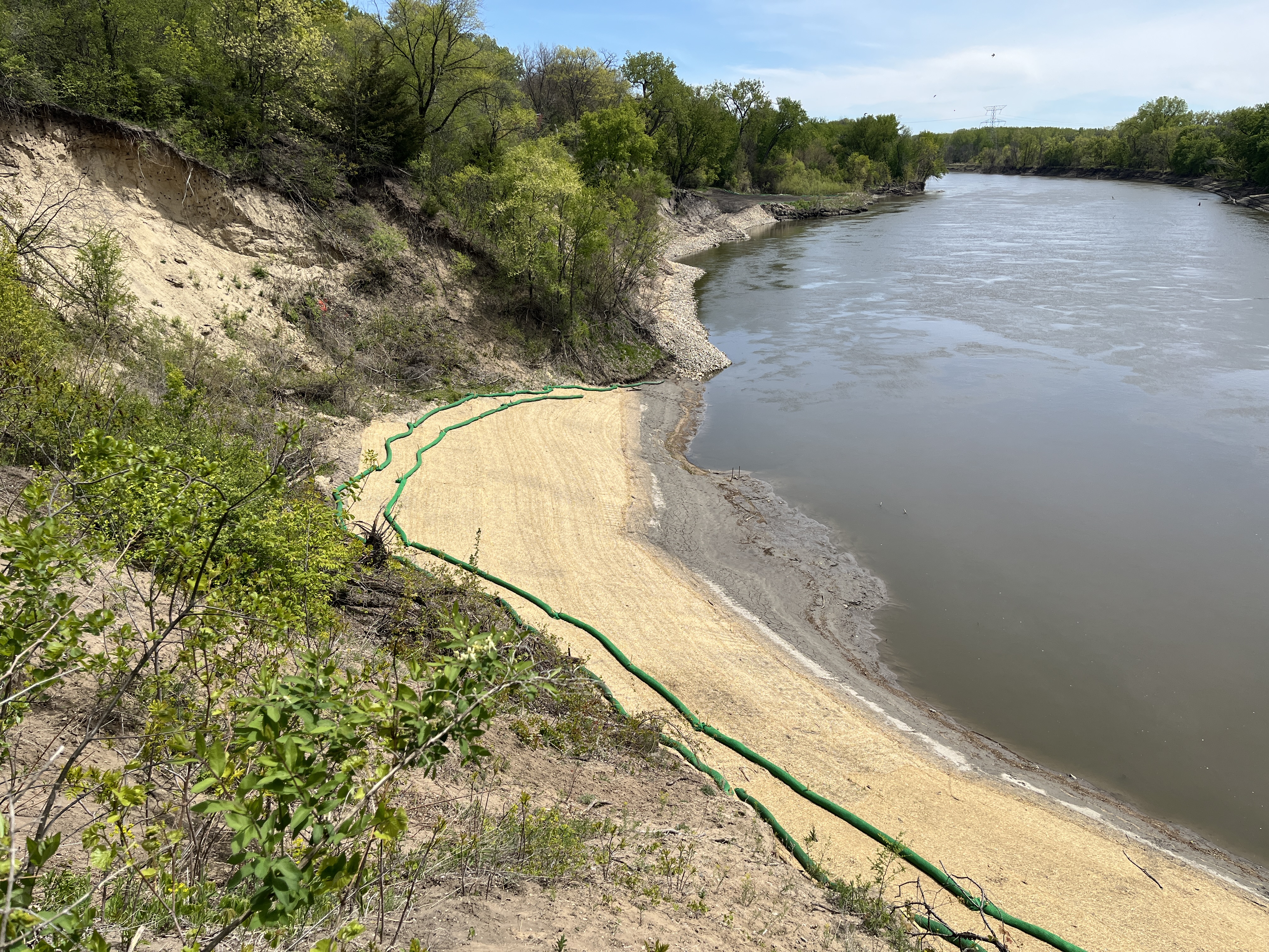
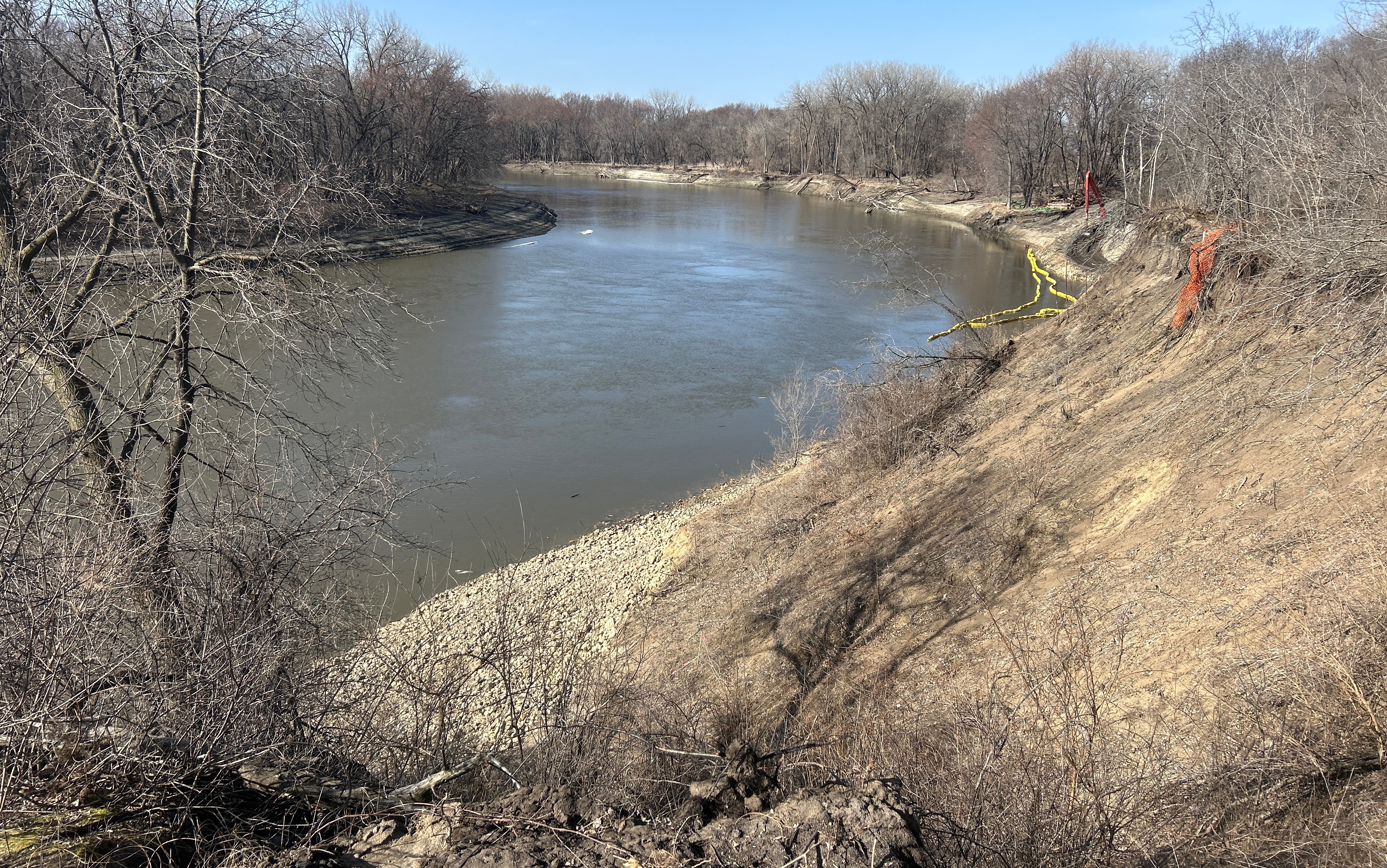
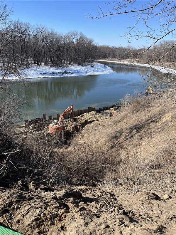
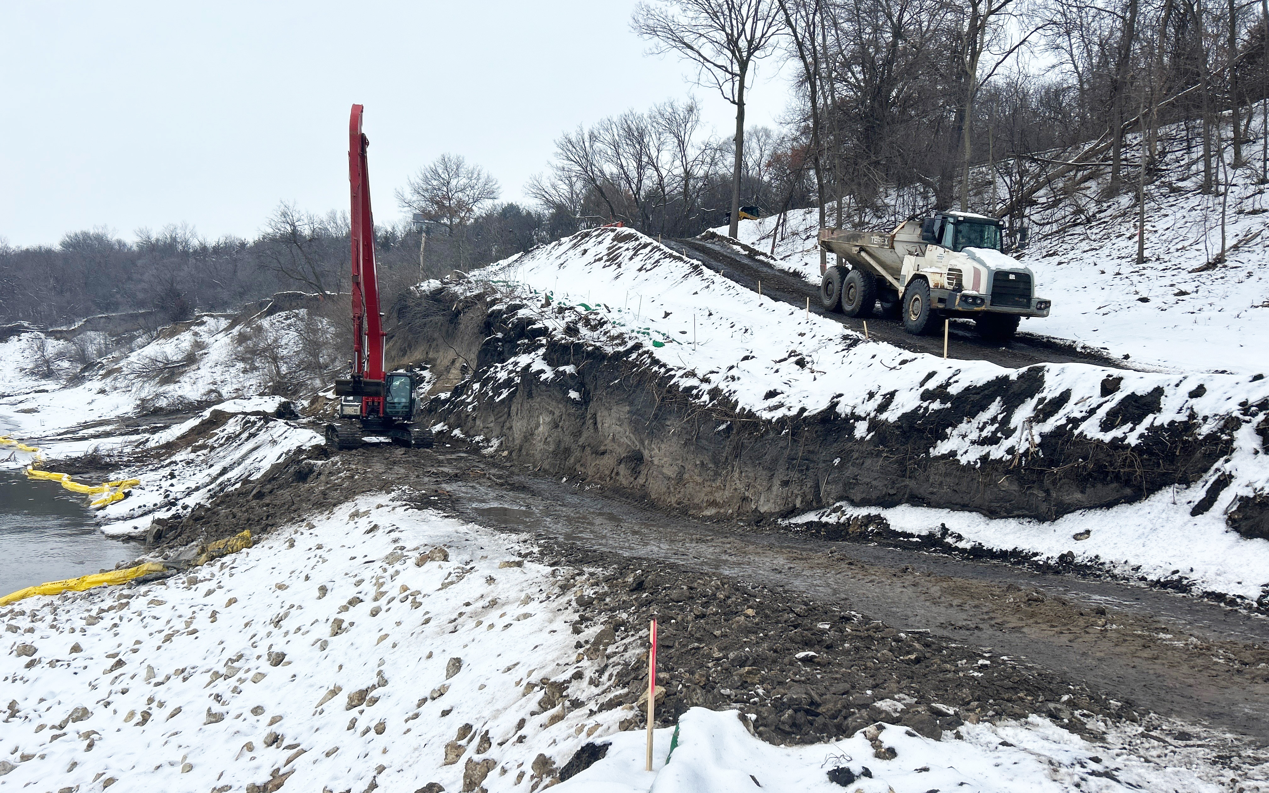
Located in Eden Prairie, at a sharp bend in the Minnesota River, the project will stabilize 1,200 feet of actively eroding riverbank on the outside bend of the Minnesota River, stabilizing the meander bend to prevent further migration and erosion downstream. The area has very steep slopes, which creates stability concerns – both for residents at the top of the bluff and for the potential impact of sedimentation in the event of a failure. The project also involves decommissioning a City stormwater pond, which was found to be contributing to the erosion. A permanent armored floodplain barrier will be placed for the City storm sewer outfall to prevent future erosion.
Funding
The $5.8 million estimated cost of constructing the riverbank stabilization will be funded through a $2.7 million grant from the State of Minnesota and a $400,000 Cost Share from the City of Eden Prairie and tax levies within the Lower Minnesota River Watershed District.
Construction Schedule
Construction began in November 2025 following a public hearing on the authorization and funding. Construction is scheduled for substantial completion by the end of February 2026 with final completion in May 2026.
Milestone Dates
- November 7, 2025 – Notice of Award
- November 18, 2025 – Pre-construction meeting
- November 24, 2025 – Construction Prep Begins
- December 2025 – Construction Begins with Earthwork
- February 27, 2026 – Substantial Completion
- May 15, 2026 – Final Completion
For a detailed project schedule by construction activity, view the full schedule here.
Hours of Construction Operations
- Monday-Friday, 7am to 7pm
- Saturday, 9am-7pm by request to City
- Contractor intends to work Monday – Friday (generally sunrise to sunset)
Safety
Neighboring communities should not access the construction site or trespass beyond marked zones. The LMRWD will provide regular updates on the website for those who are interested in tracking progress. We appreciate the community's interest and curiosity about the Area 3 project. We also want to ensure everyone can follow the project’s progress in a safe and appropriate way. Sunram, as the general contractor, maintains full control of the construction site, and all access must be coordinated directly with them. Anyone entering the site is required to have proper safety training and current safety equipment. The area is clearly marked with multiple No Trespassing signs, and the gate is locked every weekend to protect both visitors and workers.
For those who would like to observe progress without entering the work zone, the safest option is to view the site from the Blue Lake Trail, which offers a vantage point without compromising safety or site protocols: https://maps.app.goo.gl/G5cGWtaqUHSjCKid9
Future Outcomes
Once constructed, the project will reduce a significant amount of erosion and reduce the risk to bluff properties. Project success will be measured by quantifying the total amount of sediment lost to date and by comparing it to the amount of sediment stabilized by the project.
Learn more
The project website will be updated during construction so residents and stakeholders can stay appraised of progress and activities onsite. To learn more about the project background, visit the project page.
Weekly Contractor Progress Updates:
Regular progress will be tracked here during construction to share progress with neighboring communities and stakeholders who are interested. Progress updates are shared by the most recent news.
May 11, 2026: The May 11 weekly meeting was conducted on-site with the Contractor to assess progress. The Launchable Toe final grading was inspected above river level. Final touch-up grading of riprap was occurring at Station 8+00; no further placement of chinking stone or salvaged fill is planned due to higher river levels. The City agreed that aggregate material at the construction entrance can remain in-place, but the current space should not be expanded. On the access path, the contractor will reestablish surface drainage elements, such as the catch basins and berms, to convey drainage toward the river. A final as-built survey will be completed this week. The tree plantings that were originally planned for planting upslope of the Launchable Toe will not be feasible due to the steep slopes. Instead, those trees will be planted in several alternative areas acceptable to the District and City where they will be more successful for long-term growth and revegetation. Barr Engineering will review final submitted survey data to determine Substantial Completion.
May 4, 2026: The Launchable Toe construction has been completed and is now mostly underwater based on the river level. The East Floodplain Trench and riprap placement will be completed this week, focusing on work above the river level. Within the east floodplain trench, the Contractor will place stone and seed; however, this will not be placed in areas that are underwater or could flood. The Toe Wood area is complete. The final project inspection is tentatively scheduled for May 11, with substantial and final completion scheduled by May 15.
April 27, 2026: The Launchable Toe is complete to top of riprap below the waterline; remaining areas will be complete to top of riprap by the end of this week. The east trench will follow. The Toe Wood construction is complete; VRSS lifts on top of Toe Wood will be complete by the end of this week. The contractor is preparing for restoration efforts; plants have been ordered but placement will be timed for the best case of plant survival. Planting is scheduled for the first full week in May. A bio-log for erosion protection will be placed at the ordinary high water level (or about elevation 701.9 feet, per MnDNR), per MPCA guidance.
April 20, 2026: Construction activities restarted with Launchable Toe, and final riprap grading at the west side. Stone and salvaged fill was placed above the water line, working west to east. Construction of the east floodplain trench is anticipated to begin in May. The Toe Wood will be installed this week. Final construction completion is on track for May 15.
April 13, 2026: This week, the project team prepared to restart construction on April 20, 2026, pending the end of road restrictions. It is anticipated that construction will resume on Launchable Toe. The project team anticipates issuing a field change to not require placement of chinking stone, fill, and seed over riprap in areas currently submerged below river levels. Other activities will include refreshing erosion control around the site. The contractor will keep the City informed when site operations restart and coordinate with the property owner at the gated entrance.
March 16, 2026: Construction will resume when road restrictions are lifted, which is anticipated to occur sometime in early to mid-April.
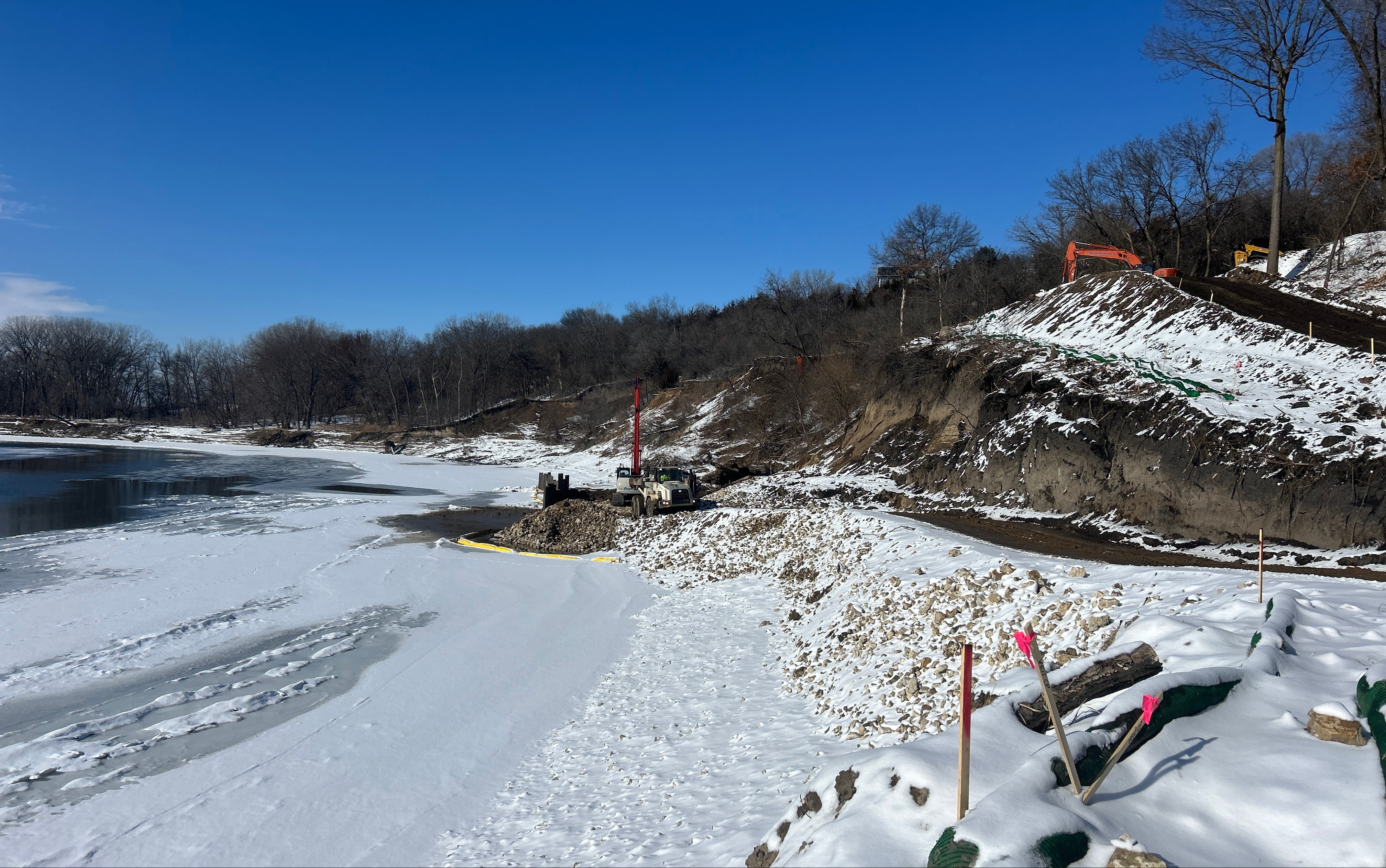
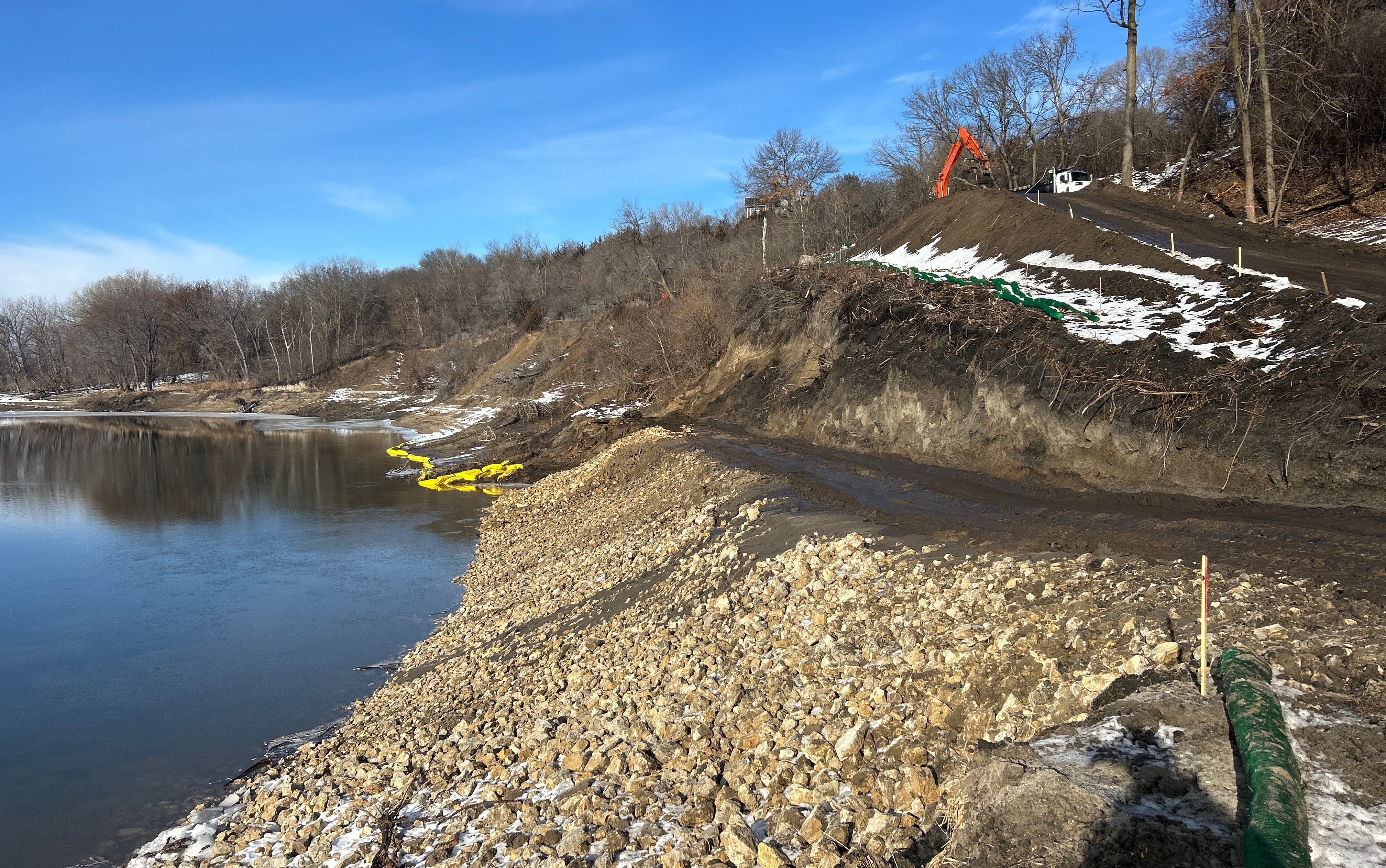
March 9, 2026: By the end of March 9, the final two Launchable Toe riprap sections connecting both sides will be completed. The team is monitoring river gauge levels (currently around 688) to determine whether to proceed with toe wood installation, as higher river levels would complicate that work. If water levels remain stable, toe wood installation should be feasible. The only remaining riprap work after March 9 is placement in the east floodplain trench, and all sheet piling has been removed. The site is being prepared for a temporary pause while road restrictions are in effect, with a focus on stabilization measures. This includes stabilizing both site entrances and implementing erosion control features. Two rows of biologs are installed at the bottom of the site, with additional biologs placed along the roadway, near stockpiled soil, and extending to the top of the slope. Rock checks will be installed where the road descends, with an additional rock check planned near the staging area to prevent runoff from flowing downhill. Road restrictions are now in effect, and hauling activities are largely complete. No further hauling is anticipated on the west end due to non-frozen ground conditions. Additional riprap survey data will be provided after March 9 once current riprap work is completed. The City will be notified if any site conditions change.
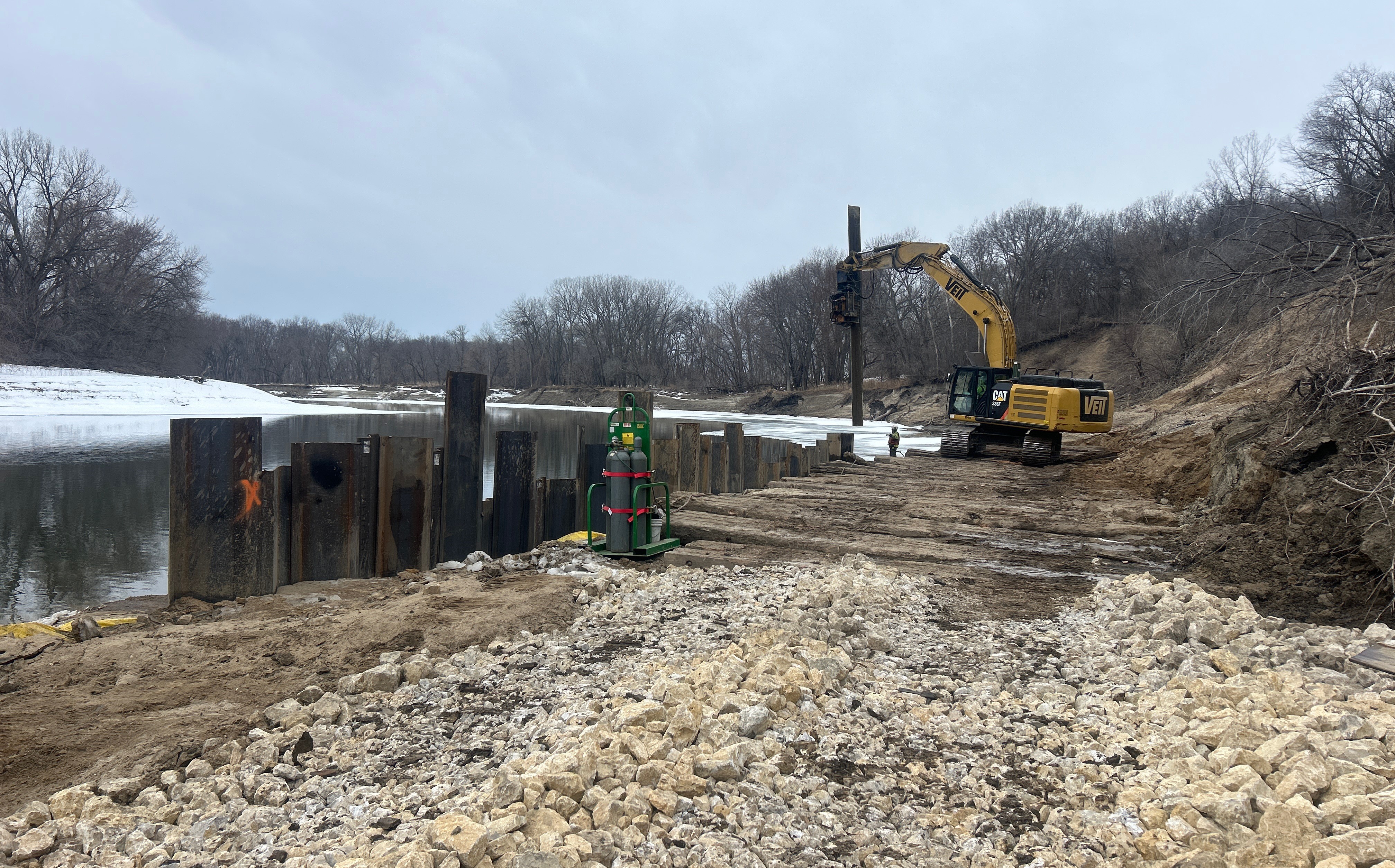
March 2, 2026: Installation of the launchable toe riprap is progressing from east to west, with approximately 150 feet remaining to fully connect the work. Veit is currently removing the final section of installed sheet pile while fill is being exported and riprap is brought onsite. There should be sufficient riprap available to complete the launchable toe. Spring road restrictions will go into effect 3/2 at midnight. Toe wood installation is also anticipated to start on Friday (3/6). Work on the top of riprap for the launchable toe will be completed first. The eastern floodplain trench work is being deferred until after road restrictions are ended. Material from the eastern floodplain will ultimately be used to cover the launchable toe. The intent is to avoid stockpiling materials onsite, with the goal of using and removing all materials on 3/2. If any stockpiling is necessary, it will be temporary and stabilized.Once all riprap is installed and shaped, Toe wood will be installed and shaped, followed by general site cleanup. After cleanup, all controlled areas will be temporarily stabilized in preparation for paused work during road restrictions. When the crew returns after end of road restrictions, they will install chinking stone on the launchable toe, excavate the eastern trench, install riprap and chinking stone in the trench, and cover it. Additional work will be required to repair access roads, which have experienced significant wear. Equipment will remain onsite during road restrictions, and all required signage will be installed and maintained. The western access route is in slightly worse condition than the eastern route but remains passable and will require restoration to existing conditions. The crew will notify the City of Eden Prairie once road repairs are complete and the site is ready for inspection. Schedule coordination will occur to discuss next steps, and riprap survey data will be reviewed internally with follow-up provided as needed.
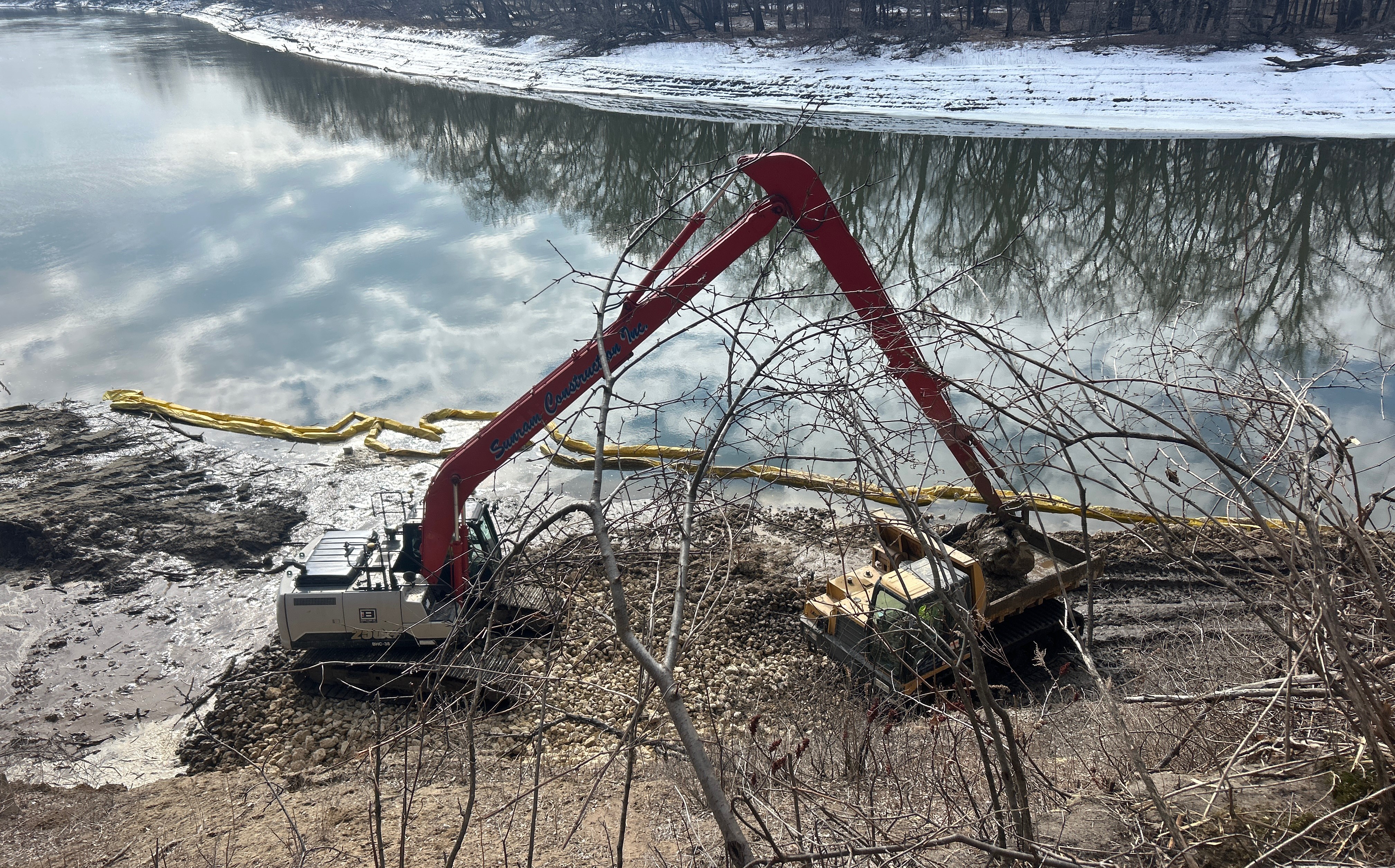
February 23, 2026: Riprap and the associated riprap trench installation for Launchable Toe began on the west side today. On the east side, Launchable Toe riprap is currently being installed between the sheet piles, with approximately 200 to 300 feet of riprap remaining to complete the section. Additional sheet pile will be required to complete the remaining 200 to 300 feet, and the contractor is scheduled to complete this work on Wednesday. This is anticipated to be the final section requiring sheet pile installation. No Toe Wood excavation has occurred yet, as the current priority is riprap placement to move as much material in and out of the site as possible before seasonal road restrictions are implemented. Chinking stone has not yet been placed, and the riprap is being installed below final grade and temporarily used as an access road. The riprap will need to be final graded prior to the placement of chinking stone. Temperatures are hovering around the freezing point, with warmer conditions during the day, and Friday is expected to be slightly warmer. All erosion control measures are in place and functioning properly. Entrances on the east side have been touched up, perimeter controls are installed and holding, and exposed cuts have shown no movement. The silt curtain is performing well, and the river remains largely open, with only approximately 25 feet of shoreline ice present. All trucks are required to use the approved haul route for access, although City of Eden Prairie staff have observed that this requirement has not always been followed. The contractor will remind truck drivers to follow the approved haul route. Survey data of recent riprap placement will be converted into AutoCAD (DWG) files and submitted for review.
February 16, 2026: Construction activities continue to be heavily influenced by warm temperatures and wet site conditions. Sheet pile installation has progressed to approximately Station 3+00, and riprap placement is nearing the same station. Due to thawing conditions, riprap hauling will be suspended as the haul road has begun to soften under muddy conditions. Riprap placement will continue using materials already stockpiled on-site. Riprap hauling will resume when temperatures cool or site conditions dry sufficiently, anticipated toward the end of the week. Completion of sheet pile installation is tentatively planned for late next week, contingent on improved conditions. The west floodplain trench riprap placement is complete. Toe wood excavation and site preparation has begun, with instructions to proceed only if materials can be installed immediately – open excavations will not be left exposed if there is risk of rainfall. Overall progress remains weather-dependent, with the contractor preparing to push forward when conditions permit. Erosion control remains a priority given saturated soils, seeps, and flowing groundwater throughout the work area. Additional floating silt curtain will be installed as temperatures continue to warm. Additional riprap is being used to stabilize backslope materials in saturated areas. No specific safety incidents were reported. Site conditions remain challenging due to mud, thawing soils, and water seepage, and crews continue to monitor access and stability closely.
February 9, 2026: The contractor is currently pulling and installing sheet pile, progressing from east to west. Work has reached approximately Station 5+00 and is moving westward. The goal is to complete roughly 250 feet of sheet pile installation, to Station 2+50, with sheeting installed on both sides, by the middle of the week. An additional 250 feet of sheet pile will still remain to be installed following this segment. Tree clearing is underway on the west end of the site near the western floodplain trench and toe wood limits. Equipment has been relocated to this area, and work on the western floodplain trench is anticipated to begin on February 10th. Toe wood installation is anticipated to begin next week. River levels are currently about 1 foot lower than they were in January. Warmer temperatures are expected, though ice remains along the riverbank. Open water is present approximately 30–40 feet from the bank. Overall, erosion control measures and exposed banks are performing well. Biologs are installed on the west side of the site, and all erosion control measures were observed to be in good condition during the morning site review. To minimize mud and tracking issues, additional rock will be delivered to the site. Both construction entrances will need to be closely monitored and maintained. If necessary, a street sweeper is available. A field meeting was held onsite on February 9 to review toe wood installation limits and confirm the planned approach. Toe wood will be installed to the elevations shown on the plans, with a 3:1 slope.
February 2, 2026: The contractor resumed excavation and riprap placement between Stations 6+00 and 5+00, with approximately three days needed to reach the extent of the currently installed sheet pile. Following this phase, work will pause to allow sheet pile installation to resume beginning Thursday, February 5. The contractor anticipates approximately one week of sheet pile advancement before riprap activities can resume. A transition from dual rows of sheet pile to a single row on the river side is expected as work progresses upstream. Overall, sheet pile installation is currently projected to be required through approximately Stations 2+00 to 3+00. The contractor has opened a second access path to the western side of the project. The contractor plans to use the west access for construction activities related to the Toe Wood and West Floodplain Trench areas during the periods of sheet pile installation. The City has requested that erosion control best management practices (BMPs) be installed along the west access route prior to conducting work. The City also emphasized the need to maintain clean hauling areas. The contractor currently has a sweeper operating on‑site to support this effort.
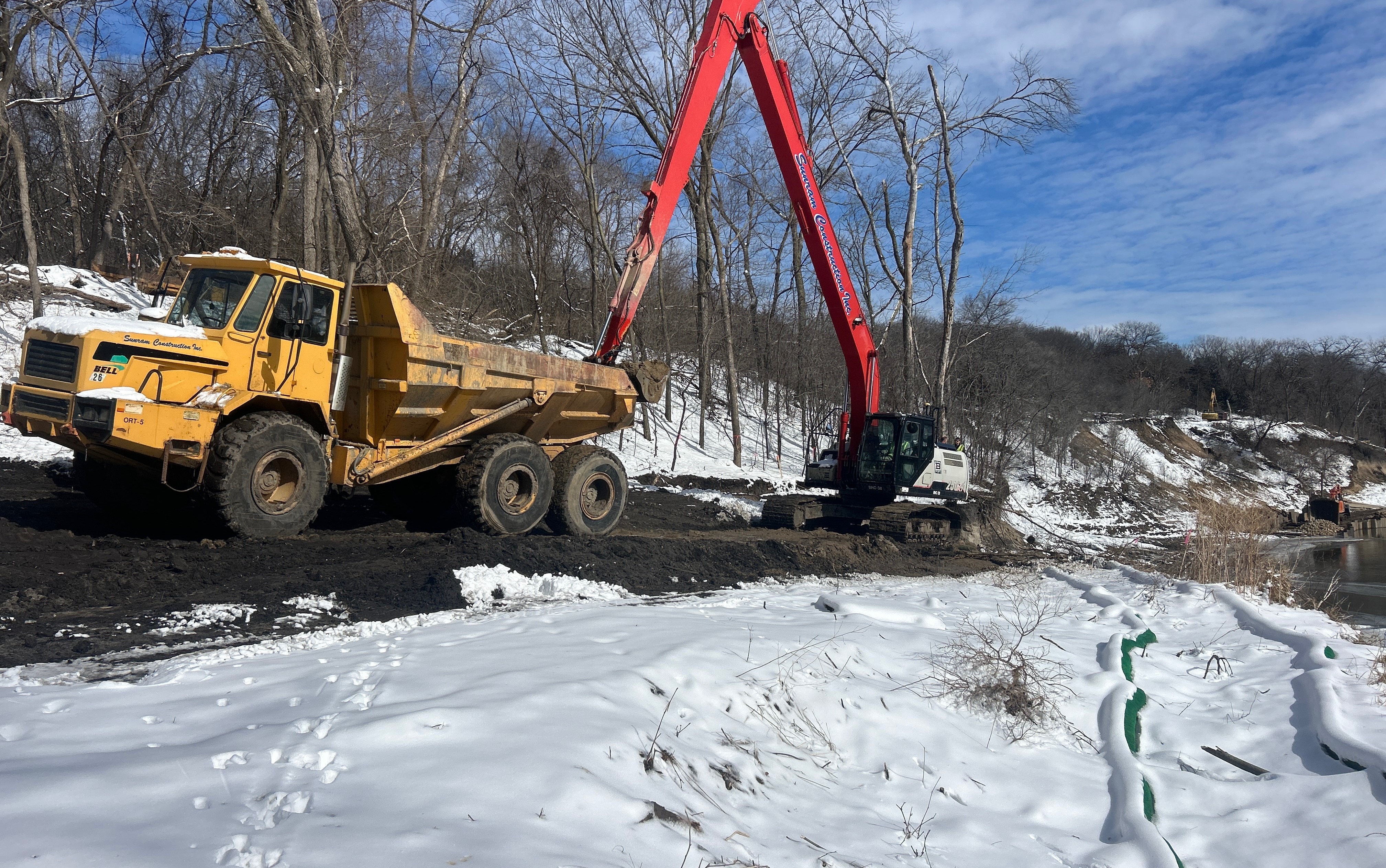
January 26, 2026: Work over the past week focused on sheet pile installation, with the contractor placing two rows of sheets from approximately Station 6+00 to Station 5+50. Sheet installation will continue upstream toward Station 5+00, at which point the contractor plans to resume excavation and riprap placement at Station 6+00. Progress has been slowed by prolonged extreme cold, as construction staff are limited in how long they can safely work outside their equipment. Operations ceased on January 23 and January 26 due to extreme cold temperatures. Weather forecasts indicate continued cold through the week of January 26, with warmer temperatures anticipated the following week. River levels remain relatively stable.
January 19, 2026: The project team reviewed construction progress and upcoming activities. Riprap placement has advanced to Station 6+00 and working from east (downstream) to west (upstream). This will be temporarily paused while the contractor mobilizes for sheet pile installation, which begins January 20. The first 250 lineal feet of sheet pile is expected to take 2–3 days. Sunram (Contractor) plans to resume riprap placement at Station 6+00 on January 26 while sheet pile installation continues westward. City outfall work is complete. The East Floodplain Trench will be the final construction task. Sunram is currently stockpiling excavated material for reuse and may pursue Saturday work pending City approval. Weather is expected to be cold, and river levels remain relatively stable. No notable updates were reported under safety, site access, quality, submittals/RFIs, permits, or change management.
January 12, 2026: Sheet piling is anticipated to begin next Monday, January 19. Erosion control will continue throughout the duration of the project. Efforts continue and Barr Engineering reminded Sunram (Contractor) to keep the silt curtain appropriately looped around the work area. Sunram reported some minor sluffing near the river, but all other exposed areas remain stable. Site Access: Sunram maintains full control of the construction site. All access must be coordinated directly with them, and anyone entering must have proper safety training and current safety equipment. Multiple No Trespassing signs are posted along the approach (three to four before reaching the site), and the gate is locked every weekend. Partners will work on developing a public statement to thank individuals for their interest while directing them to safe viewing options via the Blue Lake Trail. Submittals and Requests for Information (RFIs): Sunram will resubmit the Control of Water submittal soon as its approval is needed before commencing sheet pile installation.
January 5, 2026: The holiday is wrapped up, and Sunram (Contractor) staff are onsite. Importing of riprap will restart on Tuesday, January 6, beginning where Sunram previously left off, and heading west. The contractor is aiming for January 14 to start installing the temporary sheet pile shoring. Sunram is planning on bringing in 500 ton of riprap per day for a total of 26 days. Regarding erosion control, the exposed backslopes are reportedly holding up. The river elevation has remained consistent at approximately 688 feet, with mostly open water in the channel and ice along the banks. There have not been identified site access or issues with the public visiting the construction site over the holiday break. After processing the preconstruction topographic survey, decreases were identified in riprap, excavation, chinking stone, and salvaged fill quantities. These decreases will be documented in the weekly meeting minutes. They remain subject to change as the construction moves forward.
December 29, 2025: Note that Sunram Construction Inc. (Contractor) did not conduct work during the week of the holiday (New Year's Day). As work is paused, the site remained restricted using construction fencing and “No Trespassing” signs for clarity.
December 22, 2025: There has not been any sluffing observed from upslope. There is a softer wet area along the river where groundwater is seeping from the bank, which is being actively monitored and may require swamp mats or sheet pile to facilitate work access. All permit inspections are up to date. The public is restricted from accessing the site and entering the work limits. There are numerous “No Trespassing” signs posted. The access road is slippery due to temperatures rising above and falling below freezing. There is no stop sign for traffic along Riverview Road; anyone using this road should use caution and watch for construction vehicles entering and exiting at Mooer Lane. Note that Sunram Construction Inc. (Contractor) did not conduct work between December 21, 2025 and January 3, 2026.
December 15, 2025: The access road, staging area, and ramp from the staging area to the riverbank were completed. Sunram Construction Inc. (Contractor) began excavation and riprap replacement at the east end of Launchable Toe and work westward. The pre-construction survey work is complete, all permits have been obtained, and bio-logs and erosion control measures will be maintained during warmer weather.
December 5, 2025: Sunram Construction Inc. (Contractor) installed erosion control and began staging the area for excavation and grading and hosted the erosion control meeting with the Minnesota Pollution Control Agency (MPCA).
November 24, 2025: Sunram Construction Inc. (Contractor) moved in a gate, which will be closed and locked at night. A “No Trespassing” sign was placed. Permits are secured or underway for both (1) City right-of-way and the (2) City Land Alteration permit. Installation began on the erosion control measures. Clearing and grubbing activities began, with a topographic survey in progress. Live stake harvesting and winter seeding began to stabilize the area. Trail access at the west end of the site is gated and controlled by the owner.
November 18, 2025: Sunram Construction Inc. (Contractor) began construction with a pre-construction conference meeting. The process initiates the project team, solidifying roles and responsibilities as well as procedures and timeline. The status of permits was confirmed with the project schedule identified.
Check back for regular updates as construction continues in 2026!